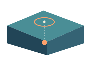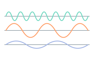
An event card shows magnitude 5.0. One person noticed dishes rattling, while someone else experienced strong shaking. Both accounts can be reasonable: the card describes the source, and the observers were in different circumstances. Reading earthquake information becomes easier when you keep event size, local shaking and the consequences for a particular building separate.

What magnitude measures
Magnitude describes the size of an earthquake at its source. Scientists estimate it from seismic records. Moment magnitude, Mw, relates to the area of fault that slipped, the amount of slip and the properties of the rock. Labels such as ML, mb and Mw identify different methods. Calling every reported value a measurement on the Richter scale can therefore be misleading.
Several estimates can exist for one event, and the source may revise its preferred value. The earthquake has not grown stronger after it happened: additional station records or a different analysis have improved the estimate. Before interpreting two reports as separate shocks, compare the event identifier, magnitude type and update time.
Why one extra unit matters
Magnitude is logarithmic. For comparable amplitude measurements, an increase of one magnitude unit corresponds to roughly ten times the recorded amplitude. A familiar approximate comparison of released seismic energy gives a factor of about 32 per unit. Amplitude and energy describe different quantities, so their multipliers are not interchangeable.
For an illustrative comparison between magnitudes 4 and 6, the difference is two units. That gives about 100 times the amplitude and roughly 1,000 times the energy. It is a comparison of event sizes, not a claim of a thousandfold increase in damage. Multiplying a count of damaged homes this way would ignore where those homes stand and how they were built.
Intensity belongs to a location
Intensity describes the effects of shaking at a particular place. The USGS uses the Modified Mercalli Intensity scale, abbreviated MMI and written with Roman numerals. Assigning intensity involves observed effects on people, objects and structures. One earthquake produces many local intensities. MMI IV does not mean magnitude 4.
Consider two neighbourhoods at similar distances from a fault: one lies on rock and the other on soft sediments. Their ground motions can differ. A person's experience also depends on the building, the floor they occupy and what they were doing. Two eyewitness accounts are useful observations, but neither is a complete measurement of the earthquake's size.
Where shaking estimates come from
USGS Did You Feel It? collects questionnaires from people who experienced an earthquake and combines their observations. ShakeMap estimates the geographic distribution of ground motion and intensity using instrumental recordings, models and available supporting information. These products complement each other. A coloured region does not imply identical damage to every building inside it.
The questionnaire count is not a count of injured people or an independent measurement of earthquake size. It reflects population, internet access and participation as well as the event itself. A small community with no reports represents a gap in observations; it does not establish that nobody there felt shaking.
A useful order for reading an event card
Start with magnitude and its type, then check depth, distance, event time and source status. Where intensity or felt information is available, treat it as a separate field. Do not assign an event's maximum intensity to your own address. Open the official report to see which location or area an estimate actually describes.
In the app, the lessons on magnitude and intensity and the adjustable educational model provide a way to explore the distinction. The model explains a principle rather than calculating shaking at your home. Saving an event as a favourite makes it easier to revisit; when returning, check cache freshness and remember that the source record may have been revised.
- Magnitude: how large was the event at its source?
- Intensity: what were the shaking effects at the stated location?
- Damage: what consequences have been established for people and structures?
FAQ
Can magnitude be converted directly into an intensity level?
There is no universal conversion for every address. Distance from the rupture, depth, ground conditions and other factors matter. Look for the source's location-specific intensity product.
Why did the magnitude change after a refresh?
The source may have received additional records or refined its analysis. Check the update time, magnitude type and event identifier. Revising the same record does not by itself indicate another earthquake.
Sources
- USGS — Earthquake Magnitude, Energy Release, and Shaking Intensity
- USGS — How Much Bigger? Magnitude Calculator
- USGS — The Modified Mercalli Intensity Scale
- USGS — Earthquakes: What You Feel
- USGS — DYFI Scientific Background
- USGS — ShakeMap Disclaimer
- USGS — Why/When Does the USGS Update the Magnitude of an Earthquake?
This is educational information. For emergency decisions, follow local authorities and official warnings.