A useful starting point for Earth science is a question prompted by a news report: where does an earthquake begin, why do estimates change or how can a fault affect the sea? Move from the planet’s structure to the process, then interpret the numbers in an event record.
Begin with what lies beneath the crust
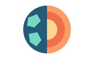
Learn the crust, mantle, outer core and inner core first. An important correction to familiar pictures is that most mantle material is solid rock that can deform slowly over geological time. Plates do not float on a continuous ocean of magma. The outer core is liquid and the inner core is solid; a diagram’s color alone does not tell you its material state.
Open the app’s lessons about Earth’s layers and mantle, followed by the layer model. Try explaining the picture without its labels. Ask which dimensions are to scale and which have been enlarged to make a feature visible. This separates an illustration from an observation before a memorable picture becomes a misleading measurement.
Connect plates, fault slip and seismic waves
A plate includes crust and the rigid uppermost mantle. Stress can accumulate on a fault, with sudden slip releasing energy as seismic waves. The focus is where rupture starts underground; the epicenter is its projection onto the surface. A large rupture occupies an area even when a map represents the earthquake as a single point.
Work through the lessons on plates, faults, the focus and waves. Compare particle motion with wave travel in the model. P waves involve compression, while S waves involve transverse shear and do not travel through liquids. The model’s speeds are illustrative. Timing an animation cannot tell you when shaking will reach your city.
Separate earthquake size from shaking at a location
Magnitude describes an earthquake’s size at its source; intensity describes its effects at a particular place. One earthquake produces different intensities in different towns. Distance, ground conditions, buildings and other factors affect those effects. Replace the question about the magnitude at your house with two questions: how large was the event, and what happened locally?
For example, moving from magnitude 4 to 5 is not a 25 percent increase. For comparable measurements, one unit corresponds to roughly ten times the recorded wave amplitude and about 32 times the energy. It does not mean ten times the shaking in every apartment. Check the reported magnitude type and explain the distinction in your own words.
Compare related processes without overgeneralizing
The volcano lessons connect magma, lava, landforms and ash. Lava is magma that has reached the surface. Volcanic ash consists of small rock, mineral and glass fragments rather than material produced by burning wood. The app’s 170 catalog records cover U.S. volcanoes: useful examples, but not a sample of every volcano worldwide.
Continue with the seafloor and tsunami lessons. Water displacement connects the topics, but an undersea earthquake does not automatically produce a damaging tsunami. Source characteristics, seafloor shape and coastal features matter. A learning model explains an idea without calculating an inundation zone. For current restrictions and protective actions, follow local authorities and the appropriate official warning center.
Build a short learning routine
Earth & Volcano Explorer provides 20 lessons with simple and detailed explanations, a fact, a quiz question and a source link. Its six model types cover layers, plates, waves, magnitude, volcanoes and tsunamis. Learning content supports 12 languages, and reduced motion helps you inspect diagrams without unnecessary animation. Choose a comfortable language while paying attention to scientific notation.
In one session, answer one question, change one model parameter and explain the result to someone else. Then examine a related record in the past-24-hour USGS feed and identify what is known and unknown. Do not infer long-term trends from one day’s sample. A wrong quiz answer is a reason to revisit the explanation and primary source, rather than guess again.
FAQ
Can a model predict the next earthquake?
No. These models simplify physical ideas, and the app shows published observations. It does not predict the next earthquake’s time, location or magnitude, or provide earthquake early warning.
Can I use the lessons for a school project?
They can help you develop questions and your own explanations. Read the linked primary sources, check terminology and identify diagram simplifications. The app’s material has not yet undergone independent scientific editing.
Sources
This is educational information. For emergency decisions, follow local authorities and official warnings.